While sailing on the Sea of Marmara, we were really looking forward to visiting Istanbul and entering the Bosphorus with our own boat — that would truly be a milestone!
Some fun facts about Istanbul on the Bosphorus:
- Istanbul has more than 15 million inhabitants
- It has over 3,000 mosques
- The city was founded 2,700 years ago as Byzantium (7th century BC), later became Constantinople, and has officially been called Istanbul since 1930
- It is the only city in the world located on two continents, Europe and Asia, with the Bosphorus running straight through the city
- The Bosphorus (also called Boğazı) is a 30 km long strait connecting the Black Sea with the Sea of Marmara
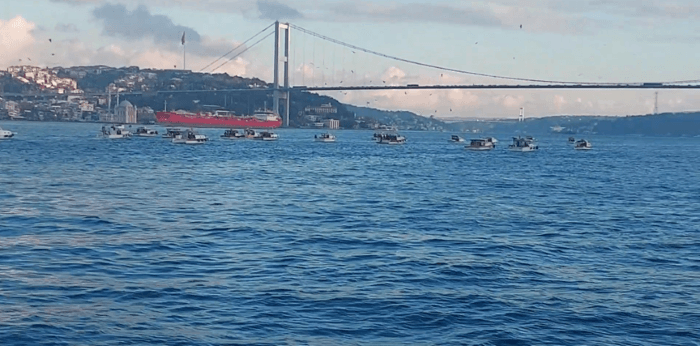
- It is one of the busiest and most dangerous waterways in the world, with sharp bends and strong currents
- More than 100,000 vessels pass through each year: about 50,000 seagoing ships such as container ships, plus countless smaller cargo ships and tankers. Ferries and water taxis also crisscross the shipping lane, connecting the European and Asian sides of Istanbul
- There are up to 2,500 ferry movements per day on the Bosphorus
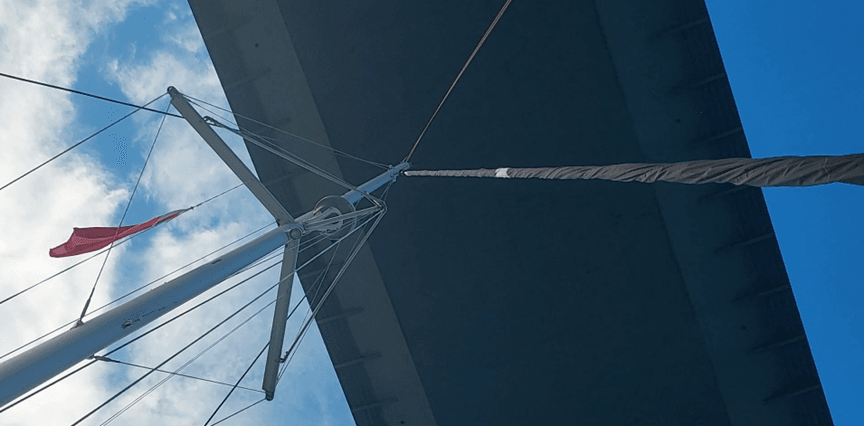
- The Bosphorus has three high suspension bridges, each with a clearance of about 64 meters at mid-span
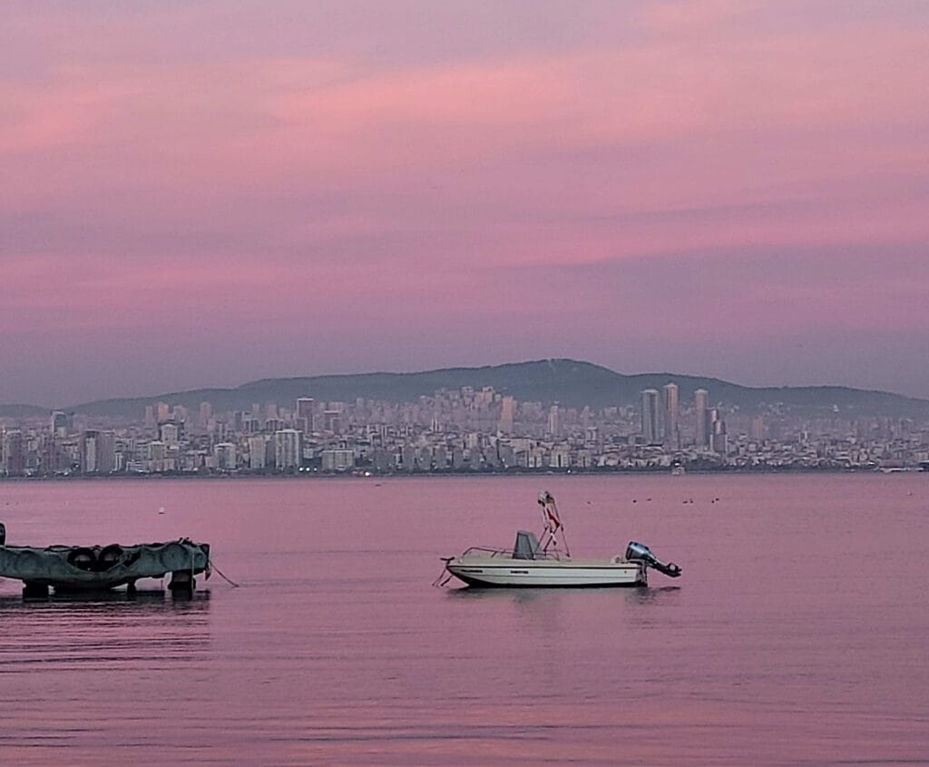
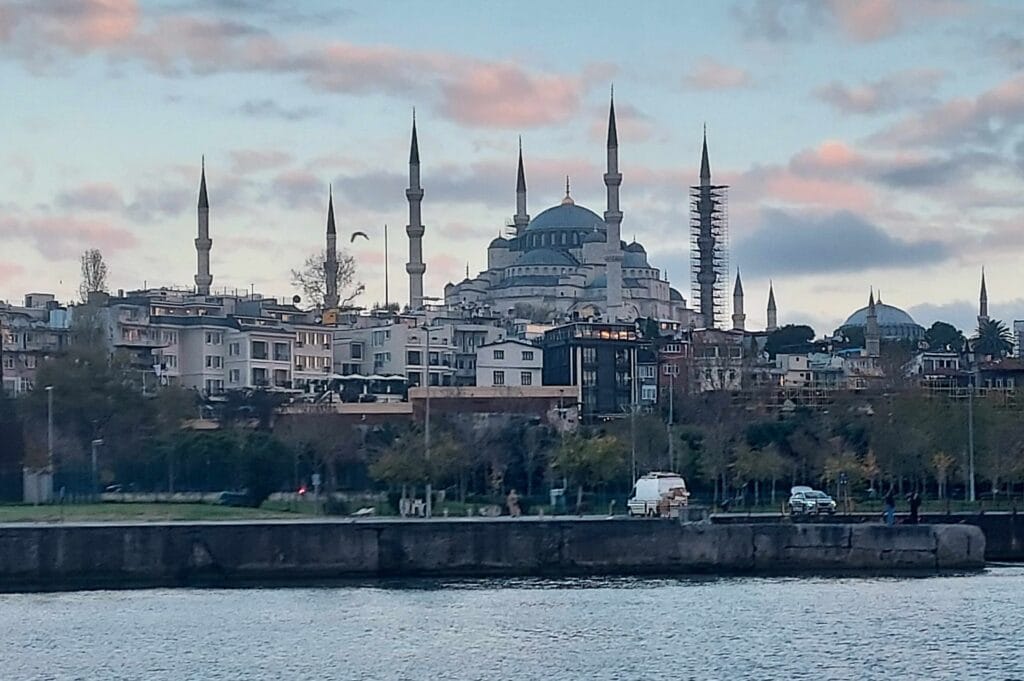
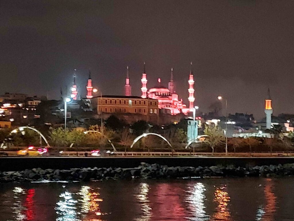
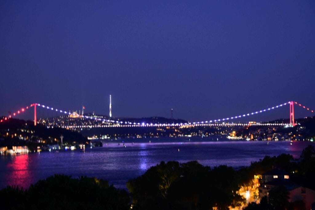
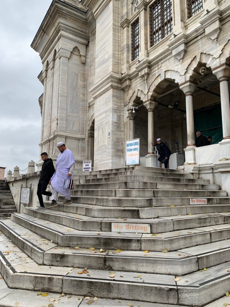
When we approached the entrance of the Bosphorus late in the afternoon, we first anchored with a view of the Blue Mosque, the famous mosque located on the southern side of the city. It sits on a high point, making it clearly visible from the water. The mosque is known for its six minarets and more than 20,000 hand-painted tiles. As darkness slowly fell, the mosque remained beautifully illuminated.
Navigation rules for the Bosphorus
We were impressed by the sheer number of vessels on the Bosphorus, and because we had read about the sharp bends and strong currents, we decided to first study the rules that evening. A bit of research gave us several important tips and some surprising facts:
- Sailing yachts are not allowed to sail under sail on the Bosphorus; they must proceed under engine power (common on busy, narrow waterways)
- The maximum speed for all vessels in the Turkish Straits (Bosphorus and Dardanelles) is 10 knots
- Always keep as close as possible to the starboard side (right side of the channel). Large seagoing ships usually travel in convoys and often one-way at a time (northbound in the morning, southbound in the afternoon) to safely negotiate the narrow bends
- Crossing the shipping lane east–west (or vice versa) must be done at a right angle (90°) and only when safe
- Maintain a continuous listening watch on VHF channel 16 (distress and calling) and the local traffic channel. The Bosphorus is monitored by Vessel Traffic Services (VTS Istanbul). VTS sectors use channels 11, 12, 13 and 14, with channel 11 often serving as the primary traffic channel
- Even small yachts (under 20 meters) are requested to report themselves 5 nautical miles (8 km) before entering. You call “Istanbul Boğazı Traffic Control” and provide your vessel name, position, direction, and request permission to transit
- Free anchoring in the Bosphorus is not permitted
- Several zones near military or strategic installations are restricted areas (marked on charts as YASAK BÖLGE — prohibited area). Getting too close may result in heavy fines or intervention
- The Bosphorus has a permanent surface current from north to south (from the Black Sea to the Sea of Marmara), averaging 2–4 knots, and peaking at 5–7 knots in narrow sections and bends
- Sailing northbound therefore takes considerably more time due to the countercurrent. Engines must be in good condition; Turkish regulations state that a vessel should be able to make at least 4 knots progress against the current
- Sailing southbound (with the current) is much faster, but care must be taken not to exceed the 10-knot speed limit
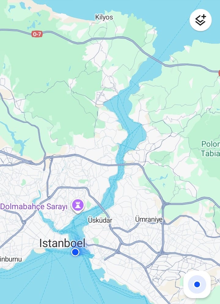
With this information, we made our plan: the next day was Saturday, perfect because commuter ferries would be less frequent. As soon as it got light at 8:00 a.m., we would enter the Bosphorus to start in calmer conditions. We would first sail north along the Asian side (starboard shore) up to the second bridge, then cross at a narrow point, and finally head south along the European side, exiting the Bosphorus again.
Maiden’s Tower
And that’s exactly what we did. At 8:00 a.m. we entered the Bosphorus. It was calm: a few fishermen, oil tankers in the distance — actually quite relaxed.
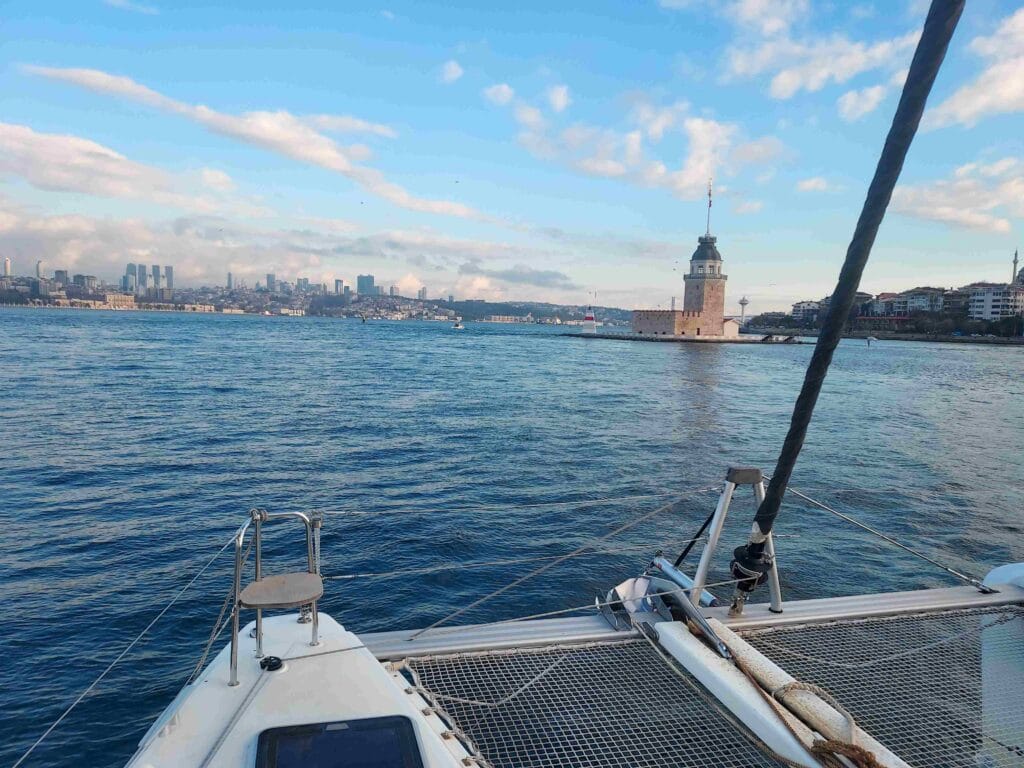
After 15 minutes along the eastern shore (Asian side), we saw our first highlight: the Maiden’s Tower. It stands on a small rocky islet in the Bosphorus near the Üsküdar district.
As early as the 5th century BC, there were references to this tower, likely used as a watchtower, for defense and as a toll post. In Ottoman times it was mainly used as a lighthouse and lookout post. Today it functions as a museum and restaurant. Over the centuries it has been destroyed and rebuilt multiple times due to fires and earthquakes.
There is also a famous legend about a princess destined to die from a snake bite. Her father locked her away in the tower to protect her — but fate could not be avoided: a snake hid in a basket of fruit. This legend gave the tower its name.
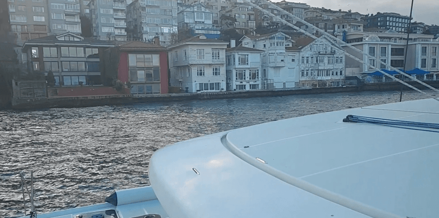
Yalıs: Ottoman wooden waterfront villas
Among the modern buildings and mosques on the Asian side, we also saw many authentic waterfront homes — often colorful wooden villas (red or yellow), many dating back to Ottoman times. We admired them endlessly.
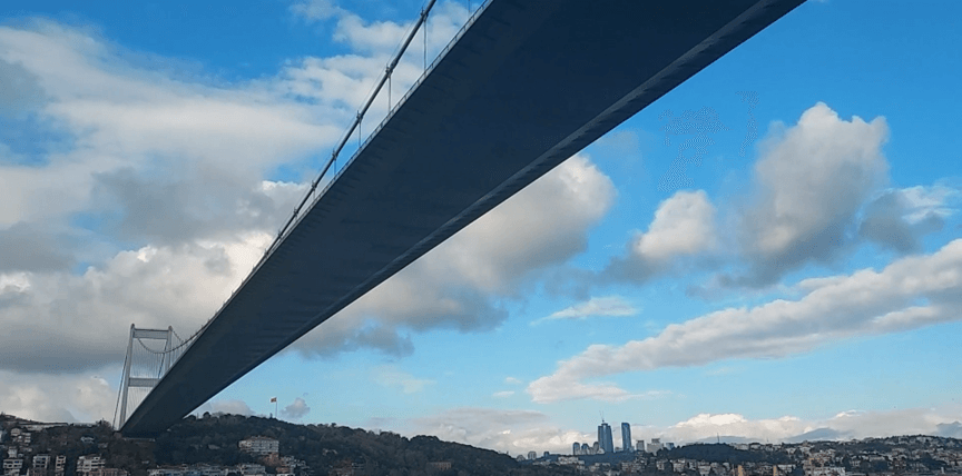
15 July Martyrs Bridge
The first suspension bridge gradually came into view. Built in 1973 (to mark the 50th anniversary of the Turkish Republic), it has a total length of 1,560 meters, spans one of the narrowest points of the Bosphorus, and offers about 64 meters of clearance, allowing cruise ships and container vessels to pass underneath.
The bridge is accessible only to motorized traffic (no pedestrians, for safety reasons). Tens of thousands of vehicles cross it daily, and in the evening it is spectacularly illuminated.
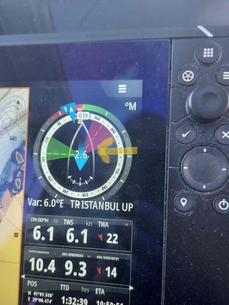
Current against us: 2.6 knots
As the Bosphorus narrowed, we noticed the current strengthening — and it was against us, since we were sailing northbound. Besides the heavy traffic, this was one of Captain Gilles’ main concerns: if the current increased to around 5 knots, it would become difficult for our catamaran (with 2 × 57 hp engines) to make headway.
After 3.5 hours of sailing, we decided it was time to make the 90-degree crossing to the other side. At a quiet moment — with a gap between container ships and fewer ferries — we crossed safely.
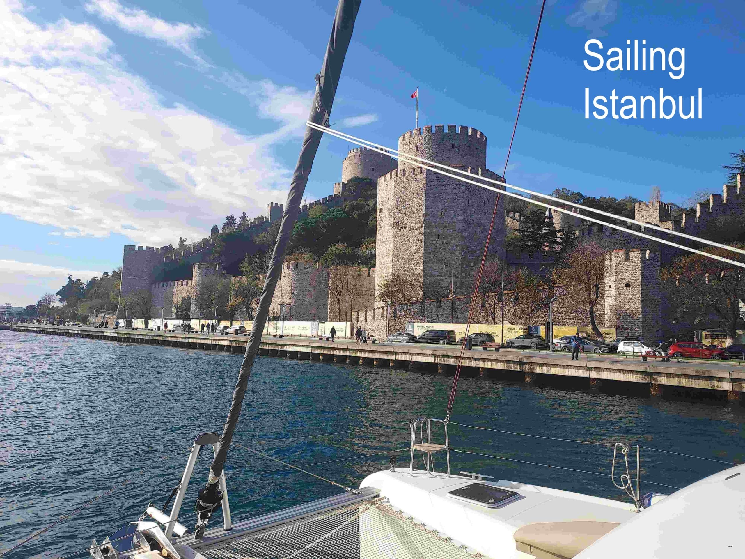
Rumeli Hisarı Fortress
We noticed that the European side had more palaces and impressive buildings than the more sober Asian side. Fewer houses, but more grand and institutional architecture — starting with this fortress, which we passed closely. A beautiful sight!
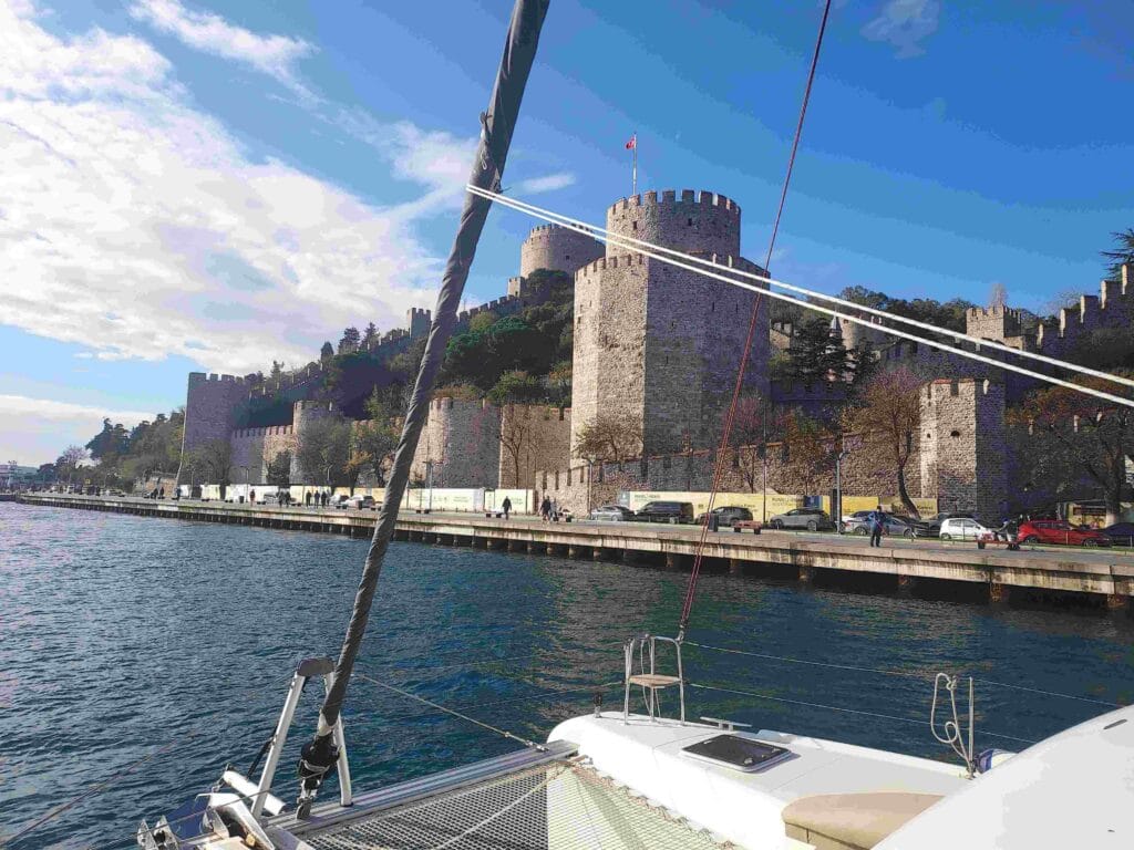
Built in 1452, it was intended to block the Bosphorus, as this was the narrowest point of the entire strait. At the time, Constantinople was under the control of the Byzantine Empire (Roman and Greek heritage, guarded mainly by Genoese and Venetian ships). The fortress was built in just four months, exceptionally fast for that era.
Unfortunately, it did not prevent history: in 1453, Constantinople was conquered by the Ottoman Empire under Mehmed II. Emperor Constantine XI was killed during the defense. The Byzantine Empire ceased to exist — an event many historians mark as the end of the Middle Ages, reshaping trade routes and indirectly stimulating the European Age of Discovery.
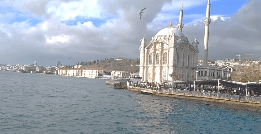
Ortaköy Mosque
This is one of the most iconic landmarks of Istanbul when viewed from the water. Amid all the ancient buildings, this mosque turned out to be relatively modern, built between 1854 and 1856. With large windows, two slender minarets, and a single main dome, it is relatively small but exceptionally elegant.
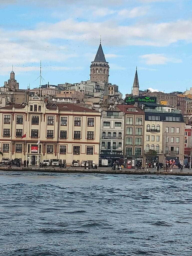
Galata Tower and Galata Bridge
Further along, we passed the Galata Tower, built in 1348 by the Republic of Genoa and originally called Christea Turris (Tower of Christ). Over the centuries it served as a defensive tower, fire watchtower, prison, and observation point.
I had visited Istanbul once before, about 15 years ago, with my good friend Suzan, and I immediately recognized this area — especially the Galata Bridge, where fishermen line the railings and where, on the southern side, you can buy fresh fish sandwiches.
The water here forms a natural inlet extending deep into the city (about 7.5 km). This is known as the Golden Horn, named for its position west of Istanbul and the golden glow the water can take on at sunset.
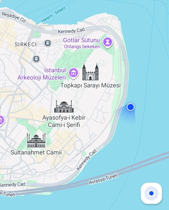
And then we entered the final stretch: the Historic Peninsula, home to the Topkapi Palace, Hagia Sophia, and once again the Blue Mosque. This marked the end of our Bosphorus tour — from 8:00 a.m. to 1:30 p.m., all enjoyed from our own boat!
I filmed all of these highlights from the catamaran. You can watch the 3-minute video here:
Dinner Cruise
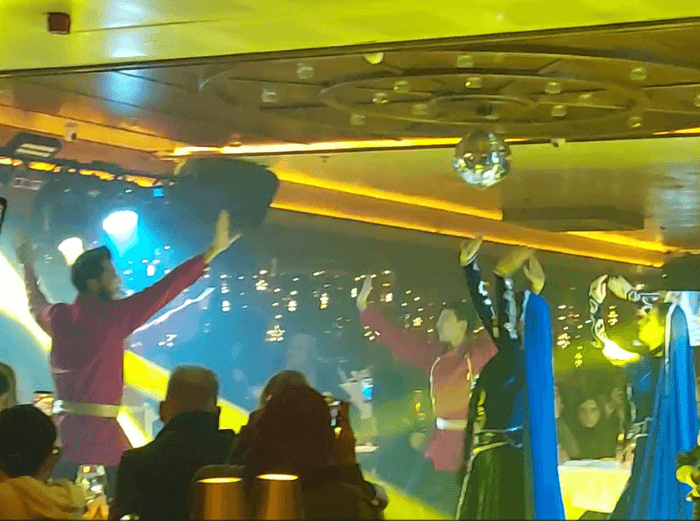
On another day, we also did a Dinner Cruise on the Bosphorus, from 8:00 p.m. to 11:00 p.m. We sailed with about 300 guests, enjoyed a three-course dinner, live music, and dance performances such as sirtaki, whirling dervishes, and belly dancing.
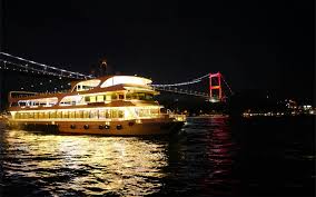
We followed the same route as our own passage, but at night everything looked completely different. It was great fun and very well organized!
Exploring Istanbul by land
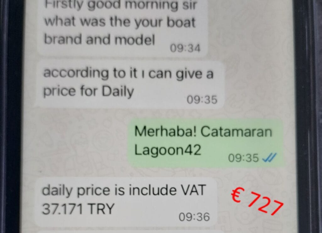
We also wanted to explore Istanbul on land, so we docked our boat in a marina and took the metro — a 1.5-hour ride to the city center. We could have moored closer to Istanbul, but the price quote we received from the harbor master (via app) for a single day’s berth was eye-watering, € 727…
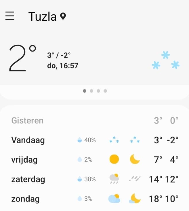
We hadn’t expected Istanbul to be so cold in winter. We spent two days there and even saw light snow. In Tuzla, the suburb where our boat was moored, the winter weather fluctuated significantly, as shown in the four-day forecast below.
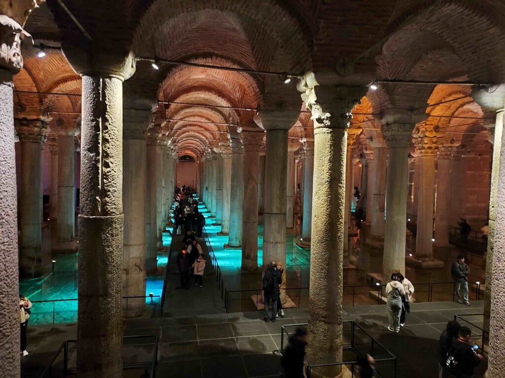
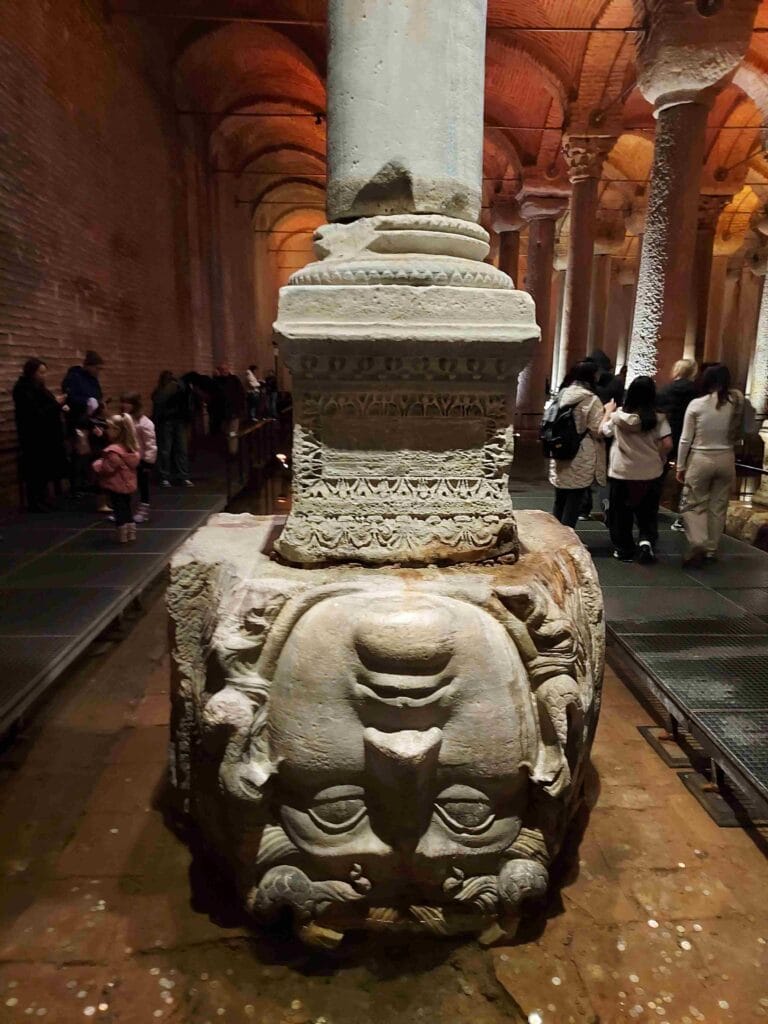
Basilica Cistern
We exited the metro in the historic center (near the Blue Mosque) and visited the Basilica Cistern, a gigantic underground water reservoir built to supply the city with fresh water. Built: around 532 AD, commissioned by Emperor Justinian I in the Byzantine period (Eastern Roman Empire).
Water was supplied via aqueducts from forests and hills tens of kilometers outside the city.
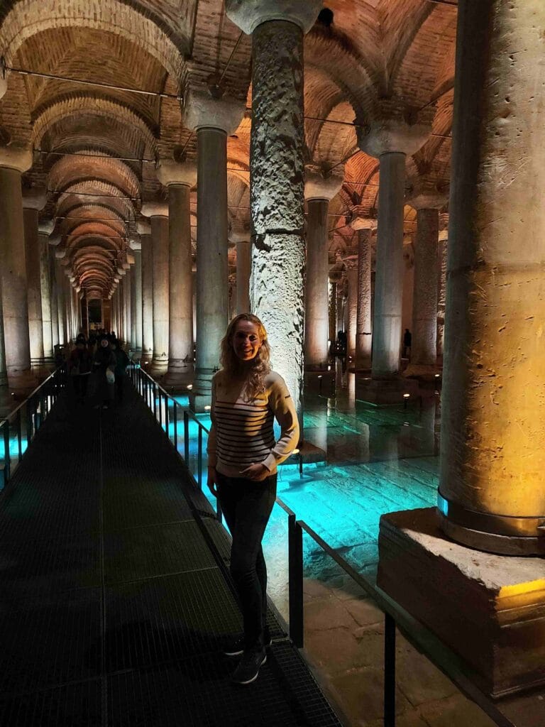
The cistern contains 336 marble columns, arranged in 12 rows of 28. Many columns were reused from older Roman temples, and the roof rests entirely on this forest of columns. At the back, you’ll find two iconic column bases with Medusa heads — one placed sideways and one upside down.
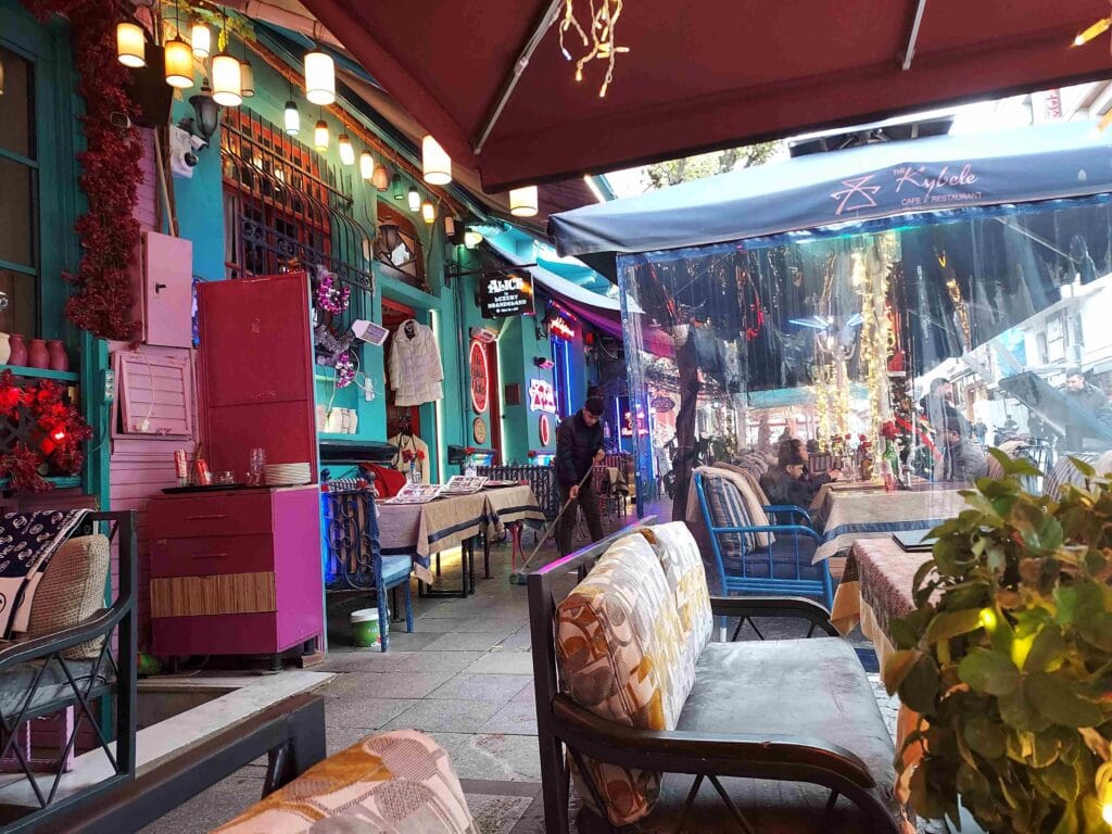
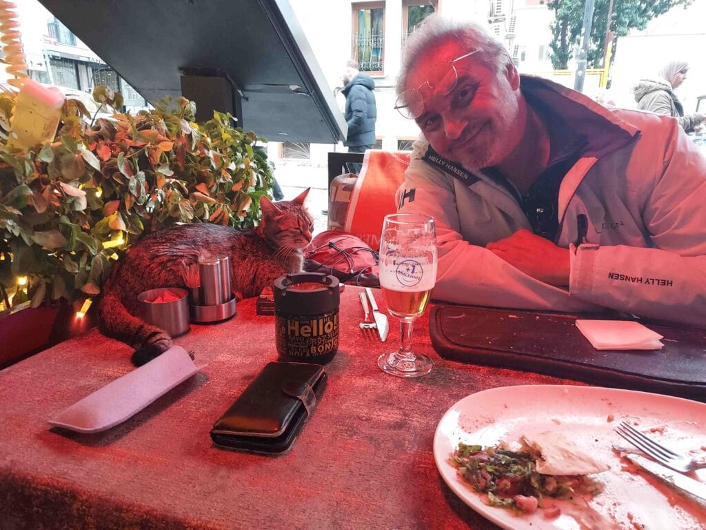
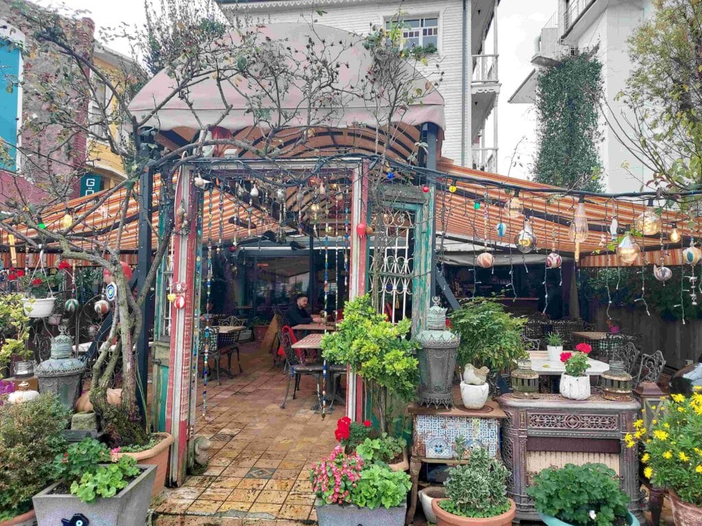
We loved the neighborhood around the cistern — Sultanahmet, the old center of Constantinople. We found charming restaurants and had lunch there. Apparently, this cat thought it was a nice place too 😉.
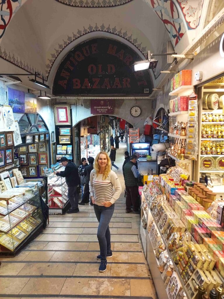
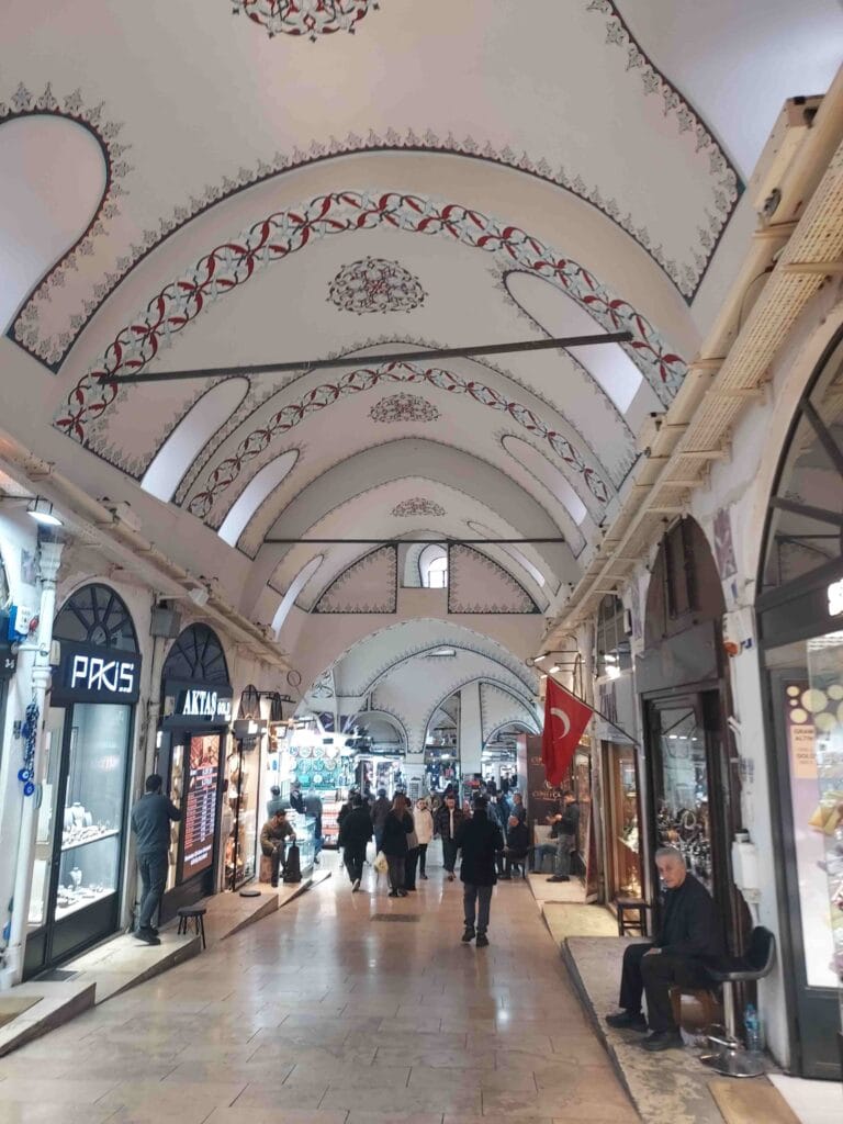
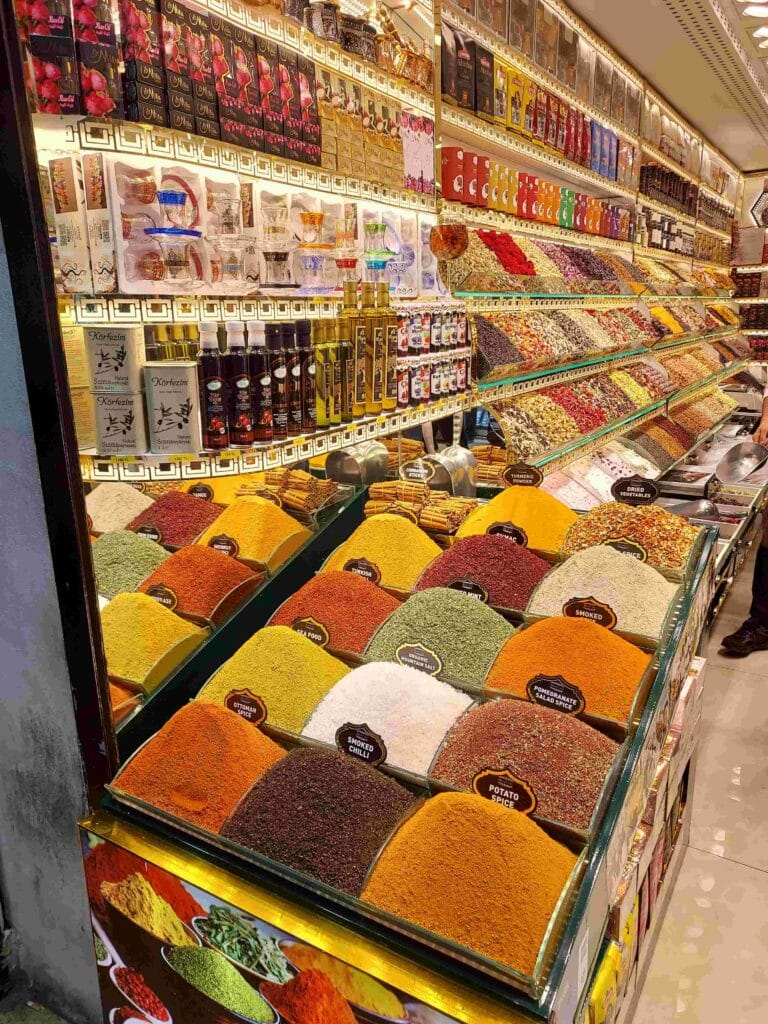
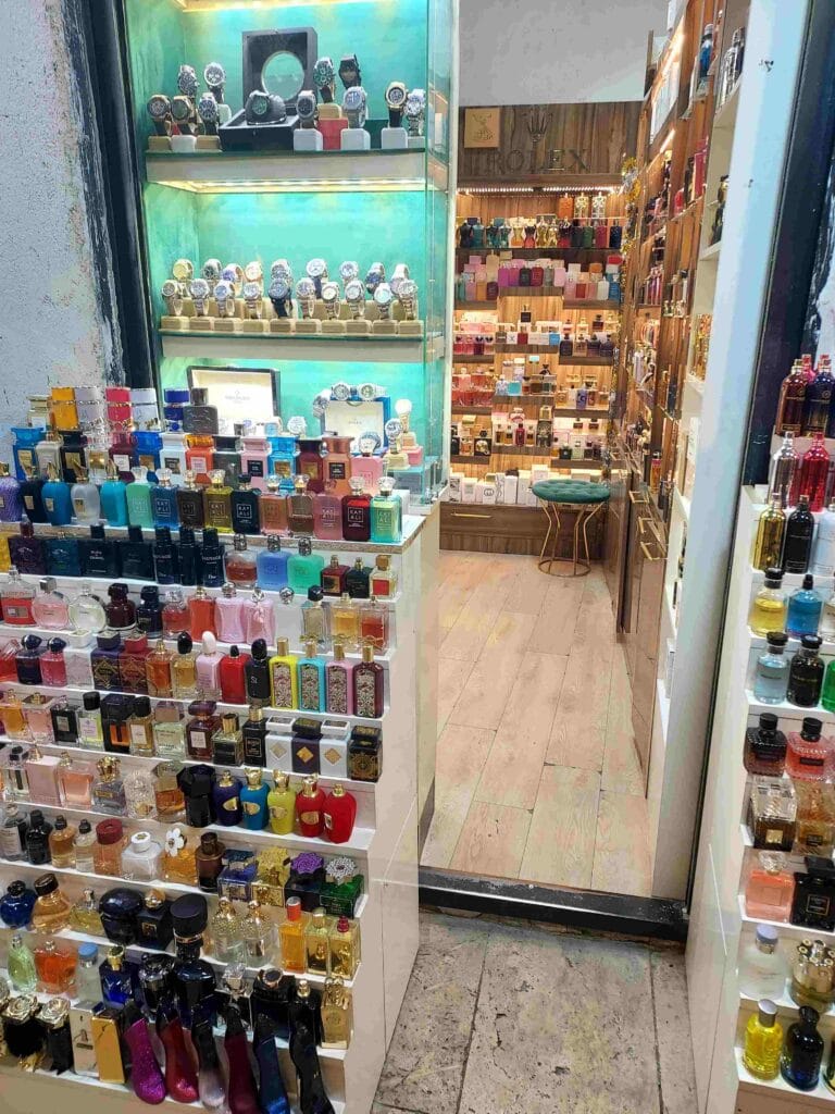
Grand Bazaar
We continued walking through the city toward the Grand Bazaar (Kapalıçarşı, literally “covered market”). This is no ordinary market, but a maze of covered streets, squares, and courtyards.
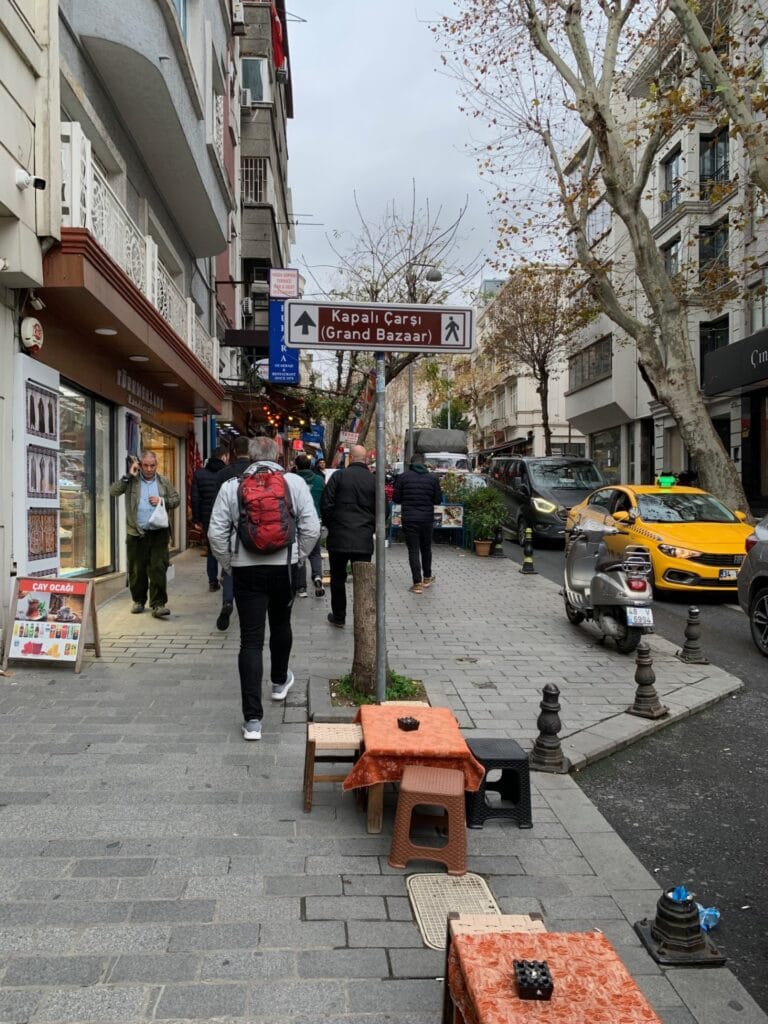
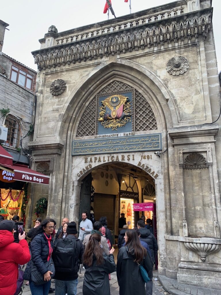
Founded in 1461, it contains over 4,000 shops across 60 streets. Each street traditionally has (and still has) its own specialization: jewelers, carpets, ceramics, lamps, fruit, clothing. It truly feels like a city within a city.
As we walked on, late afternoon approached. There is so much to see — the cityscape alone is fascinating.
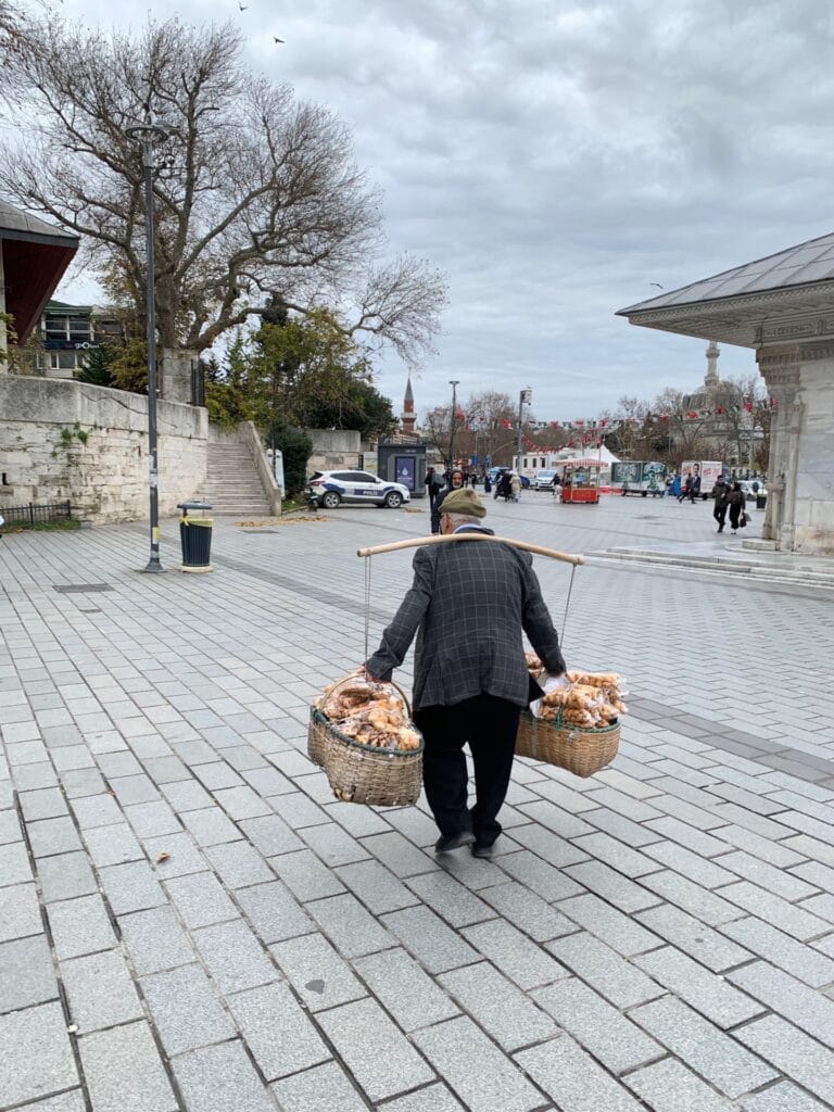
After so many kilometers on foot, our feet were getting tired, so we took the bus to Taksim Square, where we had a lovely hotel by the water, overlooking the Bosphorus. The city — active 24 hours a day — carried on around us, while we finally put our feet up.
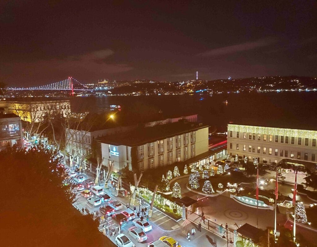
We truly enjoyed Istanbul, and the next day we returned to our own boat, with a beautiful view of Istanbul’s coastline.